top of page
3D Mapping
Powerful measurement and surveying tool now used in multiple industries.
1 h
Free Consultation
Customer's PlaceService Description
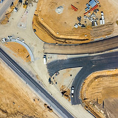
3D Mapping is being widely adopted in the Construction, Land Surveying, Real Estate, Mining, and Agriculture industries...among others. These 3D maps are generated on a regular basis which will provide visual updates on the progress of their projects, analyze stockpiles of raw materials such as dirt and gravel, or even provide accurate survey data to an accuracy of 5cm.

Contact Details
+ 513-328-0252
cpalermo@oxfordsearch.com
1101 St Gregory St, Cincinnati, OH, USA
bottom of page